
Файл:Montenegro Map.png

Арыгінальны файл (2427 × 1807 піксэляў, памер файла: 1,03 Мб, тып MIME: image/png)
|
|
Гэты файл паходзіць зь Вікісховішча. Зьвесткі пра гэты файл зь яго старонкі апісаньня прыведзеныя ніжэй. Вікісховішча — сховішча вольных мэдыяфайлаў. Вы можаце дапамагчы. |
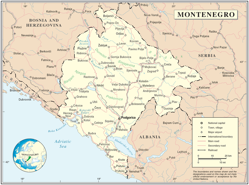
Map of Montenegro
| Апісаньне | Map of Montenegro | |||
| Дата | ||||
| Крыніца | The Cartographic Section of the United Nations (CSUN) | |||
| Аўтар | Cartographer of the United Nations | |||
| Дазвол (Паўторнае выкарыстаньне гэтага файлу) |
|

Гісторыя файла
Націсьніце на дату/час, каб паглядзець, як тады выглядаў файл.
| Дата і час | Мініятура | Памеры | Удзельнік | Камэнтар | |
|---|---|---|---|---|---|
| цяперашняя | 20:03, 10 сакавіка 2007 | | 2427 × 1807 (1,03 Мб) | Minestrone | Map of Montenegro {{Information |Description=Map of Montenegro |Source=The Cartographic Section of the United Nations (CSUN) |Date=2007-03-10 |Author=Cartographer of the United Nations |Permission={{Template:UN map}} and the cartographer of the UN [ |
Выкарыстаньне файла
Наступная старонка выкарыстоўвае гэты файл:
Глябальнае выкарыстаньне файла
Гэты файл выкарыстоўваецца ў наступных вікі:
- Выкарыстаньне ў als.wikipedia.org
- Выкарыстаньне ў ar.wikipedia.org
- Выкарыстаньне ў avk.wikipedia.org
- Выкарыстаньне ў bg.wikipedia.org
- Выкарыстаньне ў cs.wikipedia.org
- Выкарыстаньне ў cy.wikipedia.org
- Выкарыстаньне ў de.wikipedia.org
- Выкарыстаньне ў el.wikipedia.org
- Выкарыстаньне ў en.wikipedia.org
- Выкарыстаньне ў fa.wikipedia.org
- Выкарыстаньне ў fr.wikipedia.org
- Выкарыстаньне ў gag.wikipedia.org
- Выкарыстаньне ў gd.wikipedia.org
- Выкарыстаньне ў hr.wiktionary.org
- Выкарыстаньне ў ia.wikipedia.org
- Выкарыстаньне ў incubator.wikimedia.org
- Выкарыстаньне ў io.wikipedia.org
- Выкарыстаньне ў ka.wikipedia.org
- Выкарыстаньне ў la.wikipedia.org
- Выкарыстаньне ў ms.wikipedia.org
- Выкарыстаньне ў nl.wikipedia.org
- Выкарыстаньне ў pl.wikipedia.org
- Выкарыстаньне ў pl.wiktionary.org
- Выкарыстаньне ў pnb.wikipedia.org
- Выкарыстаньне ў ps.wikipedia.org
- Выкарыстаньне ў rm.wikipedia.org
- Выкарыстаньне ў roa-tara.wikipedia.org
- Выкарыстаньне ў ro.wikipedia.org
- Выкарыстаньне ў ro.wikivoyage.org
- Выкарыстаньне ў ru.wikipedia.org
Паказаць глябальнае выкарыстаньне гэтага файла.