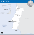
Файл:Portugal - Location Map (2013) - PRT - UNOCHA.svg

Змест старонкі недаступны на іншых мовах.
Зьвесткі зь Вікіпэдыі — вольнай энцыкляпэдыі

Арыгінальны файл(SVG-файл, намінальна 251 × 251 піксэл, памер файла: 946 кб)

Паказаць гэтую выяву наступнай мовай: .

Апісаньне

Апісаньне
English: Locator map of Portugal.
Дата
Крыніца
Аўтар
SVG genesis
InfoField
 
Код гэтае SVG-выявы слушны.
 
Гэты файл (вэктарная выява) быў створаны пры дапамозе Inkscape.
 
 Гэты SVG файл выкарыстоўвае ўбудаваны тэкст, які можа быць лёгка перакладзены ў тэкставым рэдактары.

Ліцэнзія

w:be-tarask:Creative Commons
пазначэньне аўтарства
Гэты файл ліцэнзаваны згодна ўмоваў ліцэнзіі Creative Commons Attribution 3.0 Unported.
Пазначэньне аўтарства: OCHA
Вы можаце свабодна:
  • дзяліцца – капіяваць, распаўсюджваць і перадаваць гэты твор
  • ствараць вытворныя творы – адаптаваць твор
Пры выкананьні наступных умоваў:
  • пазначэньне аўтарства – Вы мусіце пазначыць аўтарства, падаць спасылку на ліцэнзію і пазначыць, ці былі зробленыя зьмены. Вы можаце зрабіць гэта любым разумным спосабам, але не такім чынам, каб склалася ўражаньне, што ліцэнзіят падтрымлівае вас ці выкарыстаньне вамі гэтага твору.
This map is part of a collection of 216 free country maps, created by the UN Office for the Coordination of Humanitarian Affairs (OCHA), to be used in print, web or broadcast products.

The ReliefWeb Location Maps released here are maps that highlight a country, its capital, major populated places and the surrounding regions.

Attribution Requirements

Using the map without modifications: ensure that the sources and the disclaimer are below the map. Credit as follows: "Credit: OCHA".

For use with alteration: remove the OCHA logo and disclaimer following any modification to the map, but keep the data sources as mentioned below the map. Credit the modified map as follows: "Based on OCHA map". You are responsible for the content of your map.

We are keen to receive your feedback and hear how you used OCHA's maps. We would be grateful if you would notify us by e-mail and share your work with us.

UN Disclaimer
The designations employed and the presentation of material of this map do not imply the expression of any opinion whatsoever on the part of the Secretariat of the United Nations concerning the legal status of any country, territory, city or area or of its authorities or concerning the delimitation of its frontiers or boundaries.
VRT Wikimedia

Дазвол на выкарыстаньне гэтай працы быў атрыманы і захаваны ў сыстэме Wikimedia VRT.
Ён даступны як тыкет #2014031410007248 для ўдзельнікаў з рахункам у VRTS. Каб пацьвердзіць дазвол, зьвярніцеся да аднаго з удзельнікаў з рахункам VRT, ці пакіньце запыт на дошцы VRT.

Спасылка на тыкет: https://ticket.wikimedia.org/otrs/index.pl?Action=AgentTicketZoom&TicketNumber=2014031410007248
Find other files from the same ticket: SDC query (SPARQL)

Подпісы

Дадайце аднарадковае тлумачэньне, што зь сябе ўяўляе гэты файл

Элемэнты, выяўленыя на гэтым файле

адлюстроўвае

image/svg+xml

Гісторыя файла

Націсьніце на дату/час, каб паглядзець, як тады выглядаў файл.

Дата і часМініятураПамерыУдзельнікКамэнтар
цяперашняя05:02, 19 лістапада 2022Мініятура вэрсіі ад 05:02, 19 лістапада 2022251 × 251 (946 кб)Pengetik-AMFile uploaded using svgtranslate tool (https://svgtranslate.toolforge.org/). Added translation for id.
16:37, 7 верасьня 2016Мініятура вэрсіі ад 16:37, 7 верасьня 2016251 × 251 (943 кб)Wereldburger758Resized page to drawing. Removal watermark. Validation of image.
03:59, 8 траўня 2014Мініятура вэрсіі ад 03:59, 8 траўня 2014254 × 254 (920 кб)UN OCHA maps bot== {{int:filedesc}} == {{Information |description={{en|1=Locator map of Portugal.}} |date=2013 |source={{en|1=[http://reliefweb.int/map/portugal/portugal-location-map-2013 Portugal Locator Map (ReliefWeb)]}} |author={{en|1=[[w:en:Unit...

Наступная старонка выкарыстоўвае гэты файл:

Глябальнае выкарыстаньне файла

Гэты файл выкарыстоўваецца ў наступных вікі:

Мэтазьвесткі